
Five steps — and you know where to go, and if a toilet is not on the map, you can add it. The screenshots are taken from the real app and are updated along with it.
The screenshots show the Russian version of the app; in your language the buttons are in the same places and have the same icons.

The app opens on your city. Green markers are free toilets, red ones are paid, yellow ones are conditionally paid (for customers). A number in a circle is how many places are hidden behind it: zoom in.
The blue dot is you. The arrow button at the bottom right moves the map to you.

The 🚻 button opens the nearest open toilet straight away — large, with the distance and a route; “Details” shows its card. The ☰ button shows a list of the nearest ones — with distance, minutes on foot and fee, so you can choose.
Chips above the map filter out the rest: “Free” (a tap leaves only free ones), “🕒 Open now”, “♿ Accessible” (toilets for wheelchair users).

Where exactly to look: shopping centre, floor, nearest shop or café. How much it costs and how to pay. Whether it is open right now. “Which way” turns on an arrow that turns along with your phone.
At the bottom of the card are your mark, “✅ Working” or “🚫 Closed”, and photos. They stay only on your phone.

Tap the city name in the header. Markers for major cities of Russia, Belarus, Kazakhstan and Uzbekistan are saved when you install the app and are visible offline. Other cities and countries are downloaded the first time you open them — the file size is shown in advance.
“📍 Nearest to me” picks the city for you.
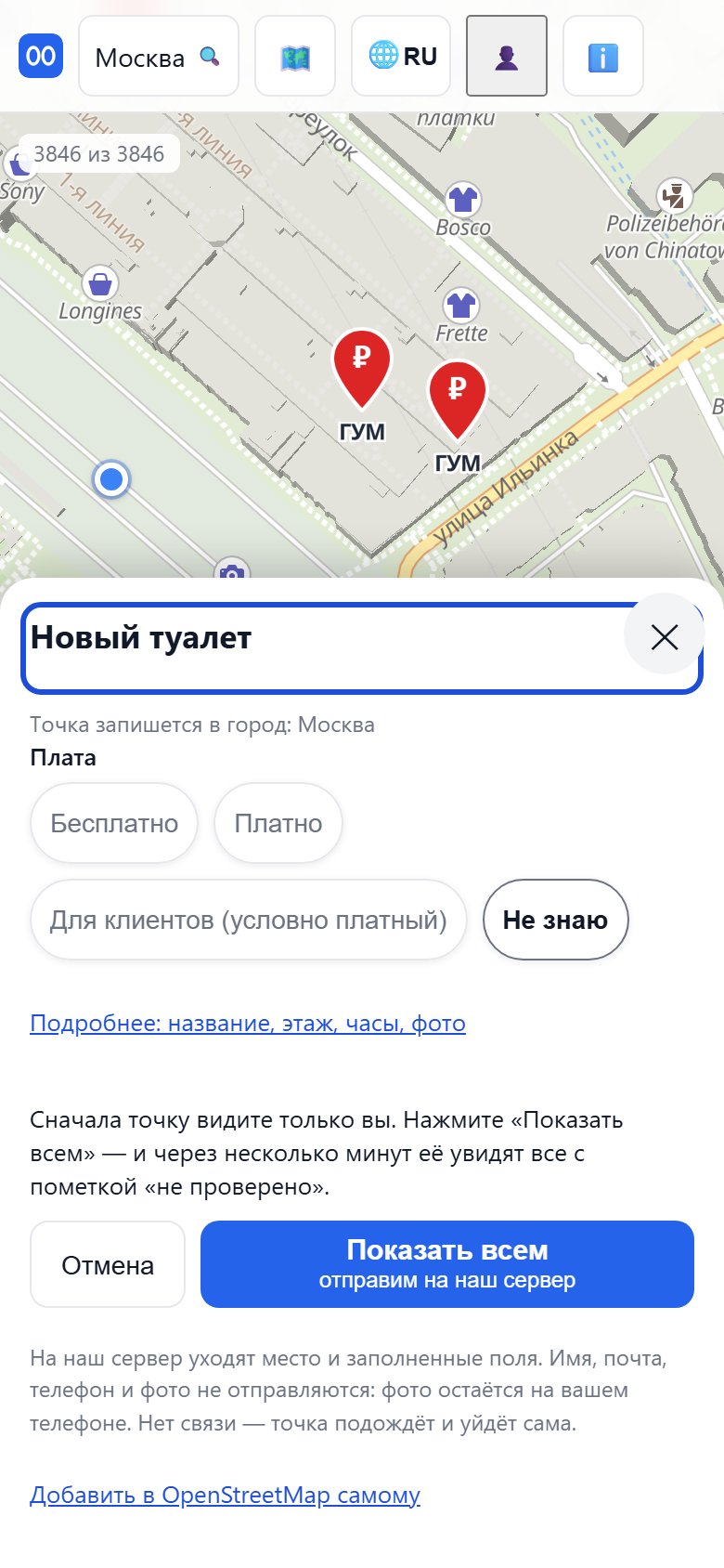
Tap the “Add a toilet” button at the bottom right — a toilet with a plus in the corner. Standing at the toilet? Tap “📍 I'm at the toilet”. If not, move the map so the toilet is under the crosshair in the middle of the screen and tap “🎯 Toilet in the crosshair”.
The form asks one thing: whether entry is paid. Name, floor, hours and photo are under the “More” link. Leave “Don't know” for whatever you do not know: a wrong “free” is worse than an honest “don’t know”.
Next comes the “Show everyone” button. It sends the details of the place to our server, and within a few minutes everyone sees the place — marked “added by a user, not verified”. Once the server has replied, “Received ✓” appears in the card. Your name, email, phone and photos are not sent: a photo stays on your phone. We review new places at least once a day.
No connection? The place waits on your phone and goes out by itself once you are online. In that case, and also if the server did not accept the place, the card also offers a fallback — “Send by e-mail”: you send that email yourself from your own mail.
If you have an OpenStreetMap account, there is also a direct way at the bottom of the form — “Add it to OpenStreetMap yourself”. From there the place reaches everyone by itself.
A downloaded city is points: where the toilets are and what is known about them. The map under them — streets, buildings, names — loads over the network, and without internet you will see markers on an empty field. To see the streets too, open the 🗺️ menu and choose “⬇ Save the … map for offline use” with your city’s name. Or tap the city name in the header and choose “🧳 Prepare a trip” — this saves the points, the map and the emergency services all at once.
Do it at home, over Wi-Fi: in another country you may have no connection, or no money for one. The saved map is listed in “Space used on this device”, and you can also delete it from there when you no longer need the city.